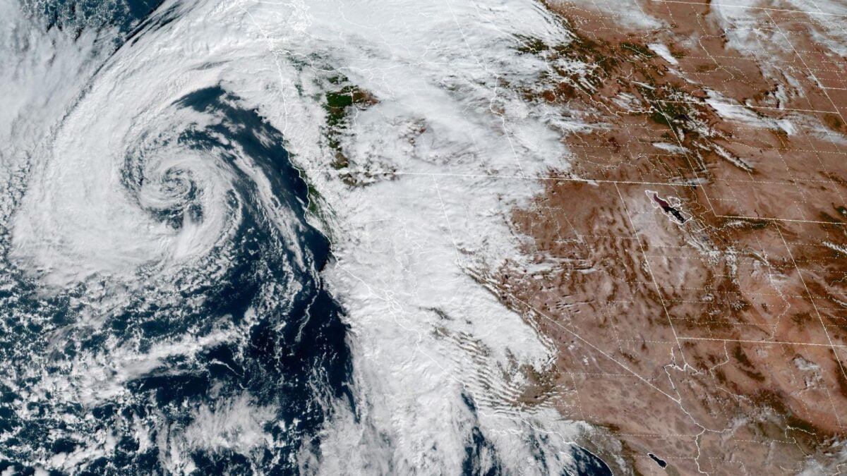
California’s historic wildfire season may end early this week as an atmospheric river drenches the state, but much-needed rain is bringing new dangers.
This storm reached California on Wednesday. Forecasters with the National Weather Service’s Los Angeles office expect it to intensify Thursday night and Saturday, warning of “periods of moderate to heavy rainfall” during these times. By Friday, Los Angeles, Ventura, Santa Barbara and San Luis Obispo counties could see 1 to 2 inches (2.5 to 5.1 centimeters) of rain. Precipitation totals of 2 to 4 inches (5.1 to 10.2 cm) more are possible in the mountains and foothills.
That said, there is considerable uncertainty about the current forecast. Meteorologists expect the atmospheric river to move quickly across Northern California, but models suggest it may stall in Southern California, potentially causing more rain than previously predicted.
Authorities are urging residents of burned-out Los Angeles to evacuate homes as flooding poses a threat of flash flooding and mudslides. The warning will be in effect from 6pm ET Thursday until 11am PT Sunday.
How wildfires make rain more dangerous
California’s wildfire season got off to an unusually early start this year when several blazes broke out in the Los Angeles area in January. Throughout the spring, summer and fall, drought conditions continued to fuel fires across the state.
According to the NWS, the intense heat from wildfires scorches the landscape and leaves behind burn marks, which can be as water-resistant as pavement. As plants burn, they release a wax-like substance that settles on the top layer of soil, making it hydrophobic. Due to destruction of plants the soil also becomes unstable and it becomes easier for rain water to reach the ground.
Therefore, there is very little rainfall to cause flash floods or mudslides in the burnt area. That’s why officials are urging Los Angeles residents to evacuate before this storm.
Possible end to 2025 fire season
Atmospheric rivers are long, narrow regions in the atmosphere that carry most of the water vapor out of the tropical regions. Although they vary widely in size and strength, according to NOAA, the average atmospheric river contains about as much water as the average flow at the mouth of the Mississippi River.
When these clouds of moisture fall to the ground, they often drop their water vapor as heavy rain or snow. That’s what’s happening in California this week. Although precipitation will fall across almost the entire state, forecasters expect Southern California to bear the brunt of the storm’s impacts.
That said, there is a silver lining. “If we don’t get the rain we expect, it will certainly move us closer to the end of fire season,” Ryan Kittel, a meteorologist at the NWS office in Oxnard, told the Los Angeles Times.
Due to climate change, experts now consider California’s wildfire season to be a year-round phenomenon, as LA’s January wildfires clearly demonstrated. That disaster was preceded by a record-long drought, which hit Southern California from late 2024 to early 2025.
This November storm could significantly reduce fire risk across California, helping prevent another winter disaster. “There was a study at the Scripps Institution of Oceanography that looked at how much rain was actually needed in the Southern California region to reduce wildfire danger and it showed that it was about a third of an inch over three days,” Scripps climatologist Julia Kalansky told KPBS.
The outcome of this storm remains to be seen, but it certainly highlights how interconnected California’s extreme weather threats are. The best-case scenario is a significant reduction in wildfire risk with minimal flooding, landslides and infrastructure damage.
